Examine the land as if you were there in person
Land viewing and presentation is the process of conveying a plot in the most realistic way digitally for investors who cannot see it on site. With drone footage shot using professional equipment, high-resolution photographs and field videos, we show the plot's surroundings, topography and potential exactly as they are. The aim is to prepare a presentation that goes beyond mere photographs and makes the plot's true location and its relationship with its surroundings understandable. Investors who are out of town or far away can thus make an informed decision without going to the site.
Imaging is not merely about producing beautiful frames; it is about making a plot easier to understand. Aerial footage taken from above with a drone lets you see at a single glance the plot's frontage onto the road, its boundaries with neighboring lands, its slope and the surrounding development. By combining this with block-parcel visualization and a surroundings-access presentation, we transform the plot's Title Deed information on paper into a concrete area that comes alive in your mind's eye.
Before requesting a viewing, you can take a look at our current listings and ask for a remote presentation of the plot you like. If you are curious about how we prepare the data side of our presentations, our article on the valuation report will give you an idea.
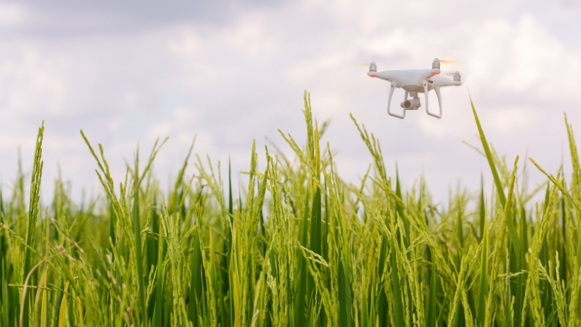
A Clear View from Above with a Drone
Seeing a plot only from the ground is often not enough; you understand the plot's true size, shape and relationship with its surroundings best from above. With professional drone footage we view the plot from a bird's-eye perspective; we clearly reveal its road frontage, slope, boundaries with neighboring plots, and developments in the immediate vicinity. This perspective directly presents to you some of the most critical information for evaluating a plot's potential.
High-resolution shots also allow you to enlarge and examine the images on screen. This way you can comfortably see details such as the parcel's soil structure, the vegetation on it, and the surrounding transportation connections. The images become a lasting reference you can share with partners or family members who influence your decision.
Understanding the Parcel with Its Location
A plot's value gains meaning not only within its own boundaries, but together with its location, access and surroundings. In our presentations we visualize the plot's distance to the road, the center and important points; by showing the block-parcel information on a map, we clarify exactly where the plot is. Thus we take the plot out of being an abstract Title Deed record and turn it into a whole picture together with its surroundings.
The presentation of the surroundings and transport provides great convenience especially for investors unfamiliar with the region. You gain a visual idea about the roads near the parcel, the neighborhood center and the developing surroundings; you grasp what kind of position the parcel is in terms of daily life and future use. This holistic view places your investment decision on far more solid ground.
Remote Presentation and On-Site Inspection
Every investor's priority is different: some prefer to inspect the plot remotely through a digital presentation, while others want to go to the site and see it on the spot. We respond to both needs. With a remote presentation, we tour the plot together via video call or the visual packages we prepare; we answer your questions instantly. This method offers great convenience when your time is limited or you are out of town.
For those who want to see the parcel on site, we organize an inspection appointment. We set a day convenient for you, guide you from the meeting point to the parcel, and on site examine together the parcel's boundaries, road conditions and surroundings. Whether remotely or on site, our aim is that you are never forced to make a decision without seeing the parcel.